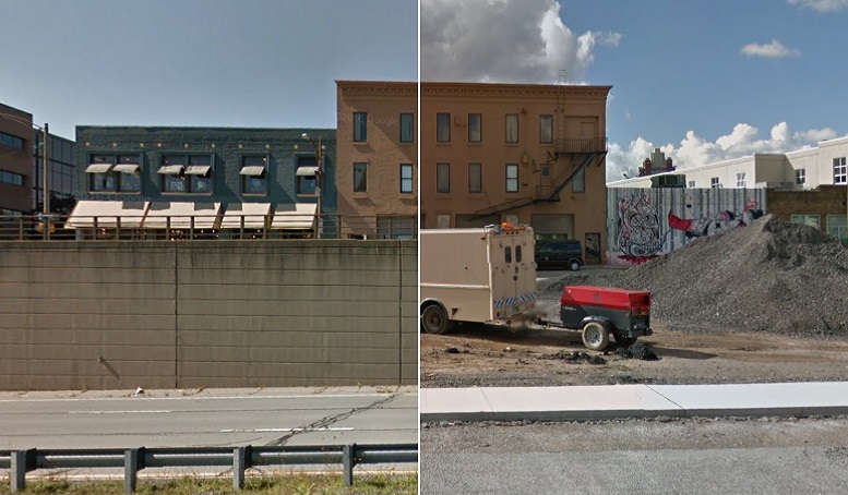
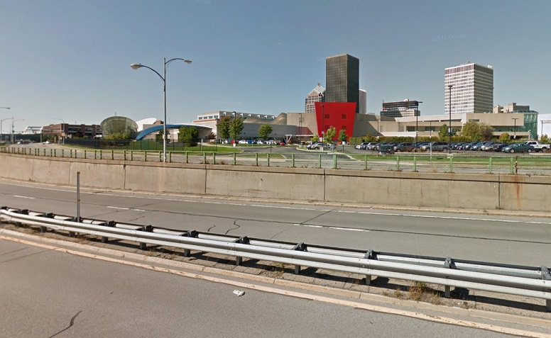
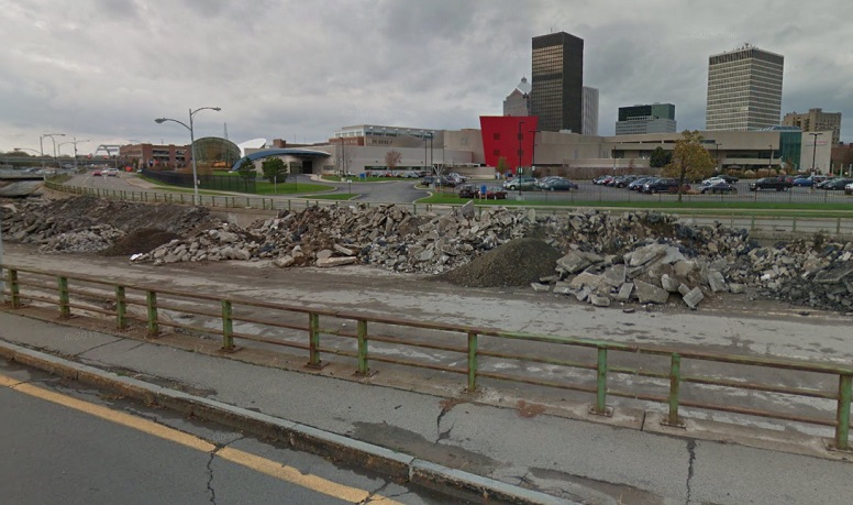
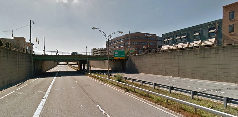
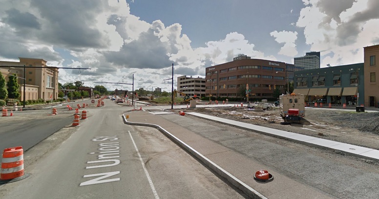
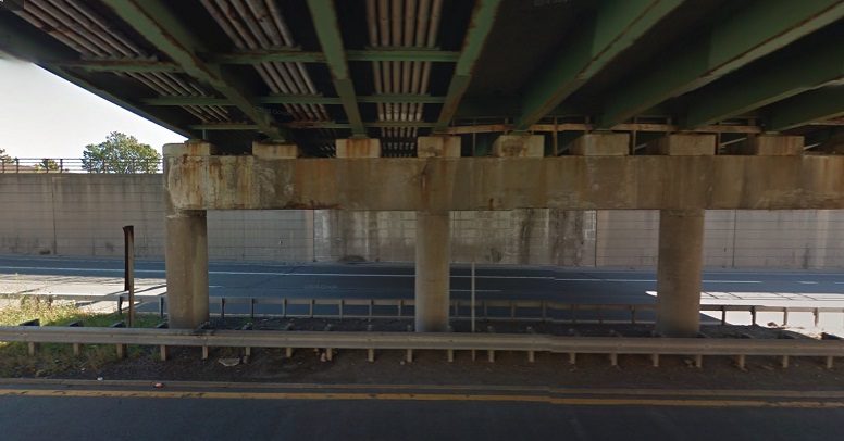
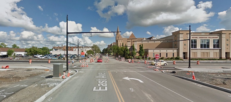
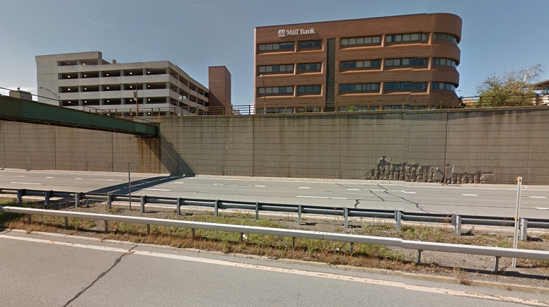
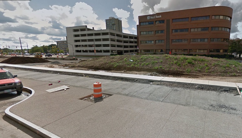
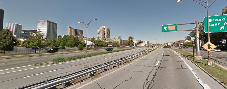
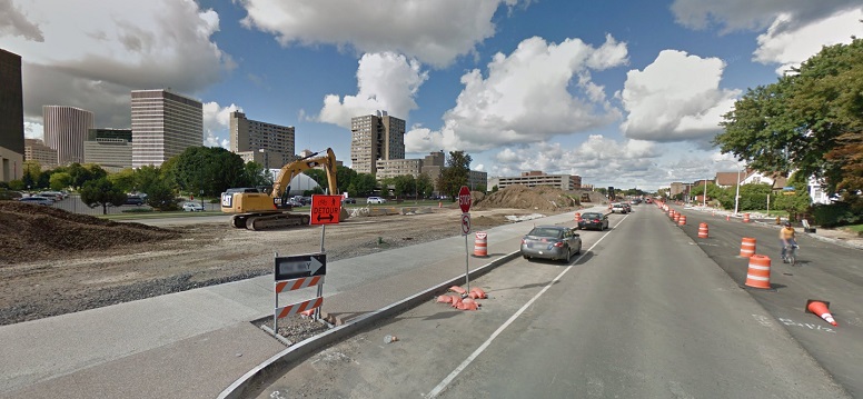
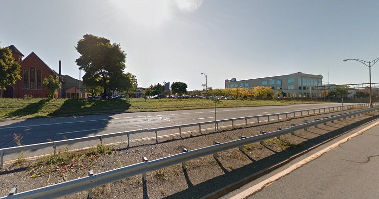
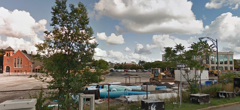
One feature (bug?) of Google Maps’ Street View mode is that sometimes we’re able to see images of streets at different points in time. This can be annoying, say if you’re looking to see what a particular block looks like today, only to find that the most recent images available are a few years old. But it can be useful too, especially if you’re trying to see where streets have undergone major changes.
Take the Inner Loop in Rochester, New York, where the city is filling in the eastern portion of the formerly-depressed highway (using mud from the bottom of Lake Ontario) and transforming the right of way into a multimodal urban boulevard with some land set aside for development too.
Using Street View, we were able to grab a few screenshots from September of 2014, shortly before the transformation began, along with some shots of what the area looked like as recently as September of this year:

[…] on the Network today: The Tri-State Transportation Campaign shows impressive before and after shots of Rochester’s “Inner Loop” highway […]
[…] on the Network today: The Tri-State Transportation Campaign shows impressive before and after shots of Rochester’s “Inner Loop” highway […]
[…] on the Network today: The Tri-State Transportation Campaign shows impressive before and after shots of Rochester’s “Inner Loop” highway […]
[…] In our book, the most ambitious project in the running this year was Rochester’s Inner Loop highway removal along South Union Street. The Inner Loop is a 1950’s-era sunken highway that cuts off downtown Rochester from the neighborhoods around it. On the east side, the city is filling in two-thirds of a mile of the Inner Loop to replace it with surface streets and walkable development. The old highway segment is gone now: […]
[…] In our book, the most ambitious project in the running this year was Rochester’s Inner Loop highway removal along South Union Street. The Inner Loop is a 1950’s-era sunken highway that cuts off downtown Rochester from the neighborhoods around it. On the east side, the city is filling in two-thirds of a mile of the Inner Loop to replace it with surface streets and walkable development. The old highway segment is gone now: […]