Beyond the Region is a sporadically-published edition of MTR, which will document the transportation-related components of TSTC staff members’ travels. Earlier this month, TSTC Communications Director Joseph Cutrufo took a family road trip to eastern Virginia.
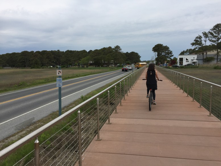
We headed south on the New Jersey Turnpike, down through Delaware, Maryland, and into Virginia. Our first stop was Chincoteague Island, located on the sea side of Virginia’s Eastern Shore. Chincoteague and the adjacent Assateague National Seashore are known for their wildlife, but the area is a great place for bicycling too.
A boardwalk connects Chincoteague Island’s main road, Maddox Boulevard, with the Chincoteague National Wildlife Refuge, which features bike paths and some scenic roads that are (mostly) car-free.
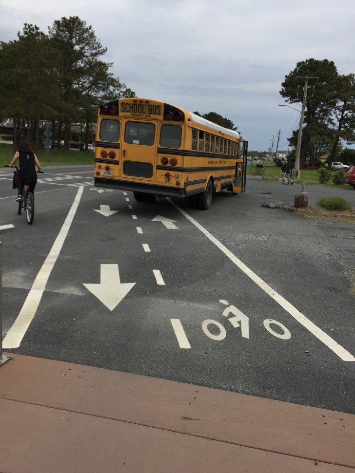
And, we learned you can travel quite a ways from New York City into a pretty remote area and still find someone blocking your bike lane.
From Chincoteague, we drove down the Eastern Shore and across the Chesapeake Bay Bridge Tunnel to Norfolk, Virginia.
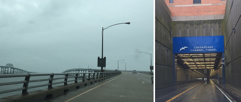
If you’re interested in transportation, Norfolk has a lot to offer. The city is home to the only three bridge-tunnel complexes in the country, the southeastern terminus of Amtrak’s Northeast Corridor, the deepest port on the East Coast, Mile Marker 0 of the Intracoastal Waterway, and the headquarters of the Class-I Norfolk Southern Railway.
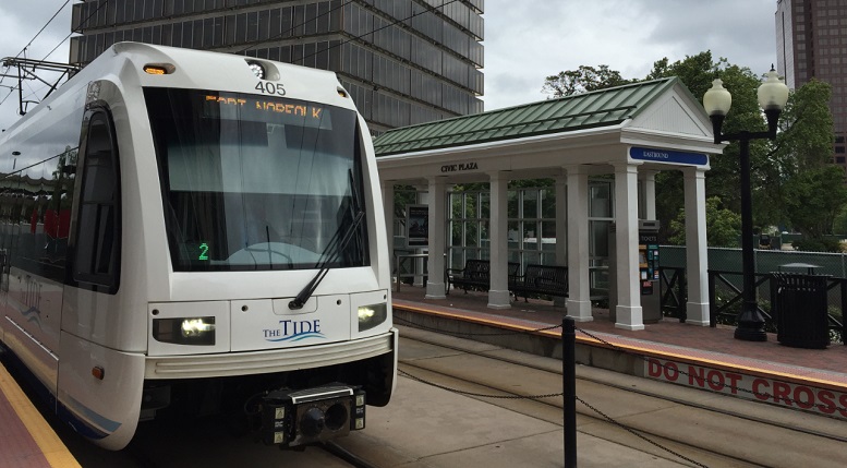
Norfolk is also home to a light rail line known as The Tide, which has the highest per-passenger subsidy of any rail line in the nation. Knowing that, we weren’t too surprised to find so few riders on a weekday evening around 5:30.
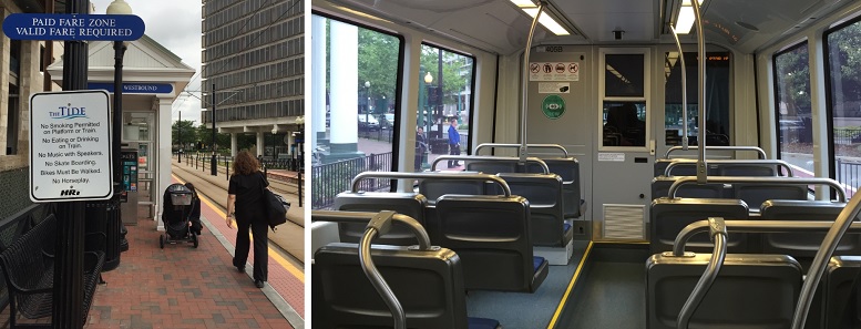
While the eastern portion of The Tide runs along a dedicated right of way, in downtown Norfolk it runs on street, but in a raised, exclusive lane.
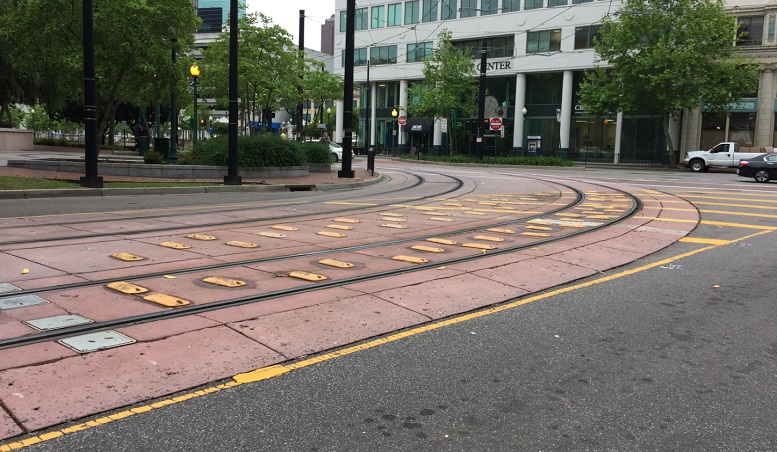
The on-street light rail right-of-way has raised rumble strips, ostensibly intended to keep cars off the tracks.
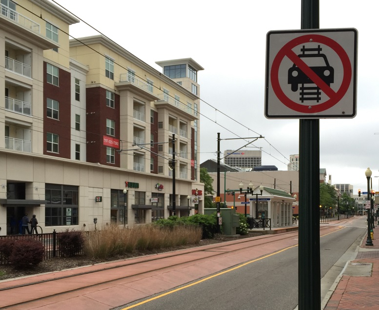
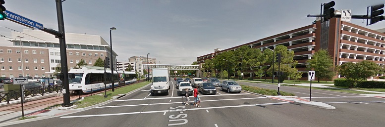
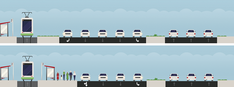
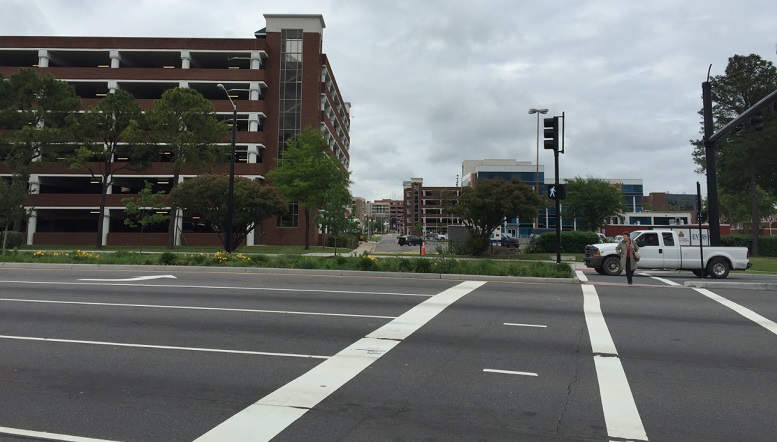
The immediate area around The Tide’s western terminus at Brambleton Avenue and Colley Avenue near Eastern Virginia Medical Center leaves a lot to be desired. Brambleton is a high-speed, multi-lane arterial that serves as a major east-west thoroughfare. Mix in a very narrow wedge of pavement for people to stand while waiting to cross Brambleton, and you end up with a rather uncomfortable pedestrian experience.
There’s a pretty obvious solution: bump out the curb by removing the right-turn bay. This would allow for either an extra wide sidewalk, or the installation of a light rail platform on the north side of the right of way — removing the need for pedestrians to cross over the tracks. Here’s a re-imagined cross-section we designed with the help of Streetmix:
Also surprising about The Tide’s western terminus was the lack of transit-oriented development. There’s a senior housing complex about a quarter-mile south of the station, and an older apartment complex across Brambleton to the north. Other than that, there’s the hospital and lots of parking. In the photo below, looking north across Brambleton, you can see three parking structures. And the person crossing Brambleton was one of only two pedestrians we saw in the area.
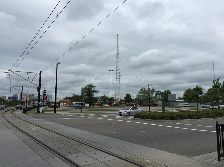
Looking east toward downtown Norfolk.
Hampton Roads Transit plans to eventually extend The Tide to Virginia Beach, and there are proposals to build new lines connecting downtown Norfolk with Old Dominion University, Naval Station Norfolk (the world’s largest naval station) and Norfolk International Airport. But as long as driving and parking around downtown and the medical center remains cheap and convenient, it seems like there’s not much incentive to use light rail in Norfolk today.
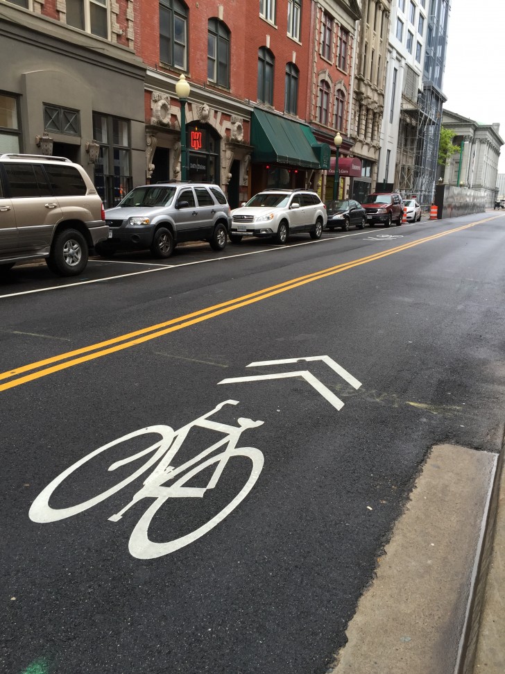
Still, Norfolk’s urban core is quite walkable, and it seems like the city is putting some effort into becoming more bike-friendly, too. There’s a pretty fantastic multi-use path which runs along the waterfront and through the historic West Freemason neighborhood, which earned praise from the American Planning Association in 2013. In the downtown area, we noticed some shared lane markings…
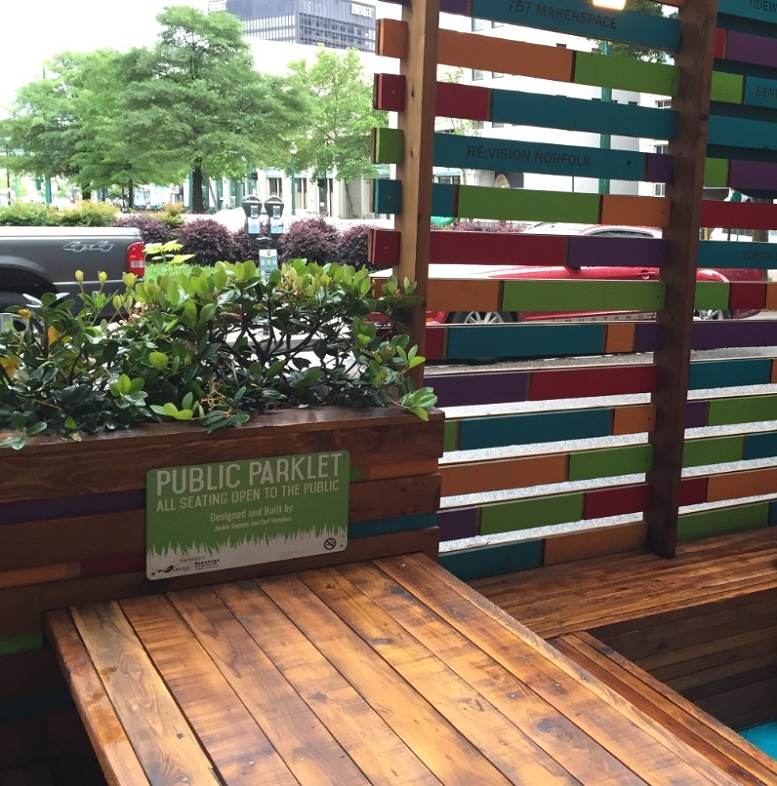
Some parklets…
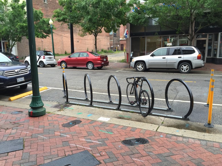
And even a few bike corrals.
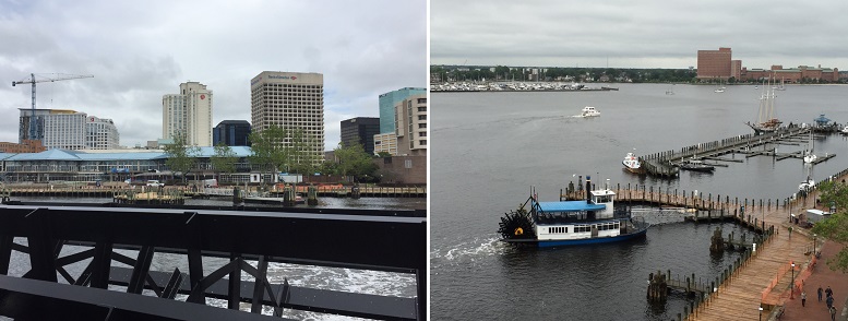
Downtown Norfolk is also served by HRT’s paddlewheel-propelled Elizabeth River Ferry, which makes stops in Olde Towne Portsmouth, Virginia.
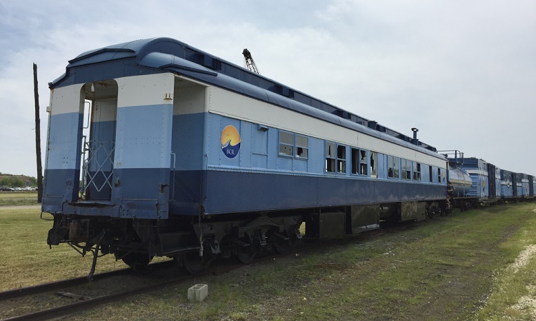
Heading back north, we made a stop in Cape Charles on Virginia’s Eastern Shore, where we stumbled upon some Bay Coast Railroad cars sitting in a lot near the town’s main commercial street. The railroad, which extends from Pocomoke City, Maryland to Norfolk, is another of the region’s transportation oddities: it operates one the nation’s two remaining car floats (the other one, of course, is right here in our region: NYNJ Rail, which operates a car float between Jersey City and Brooklyn).
Soon we were headed back to New York.
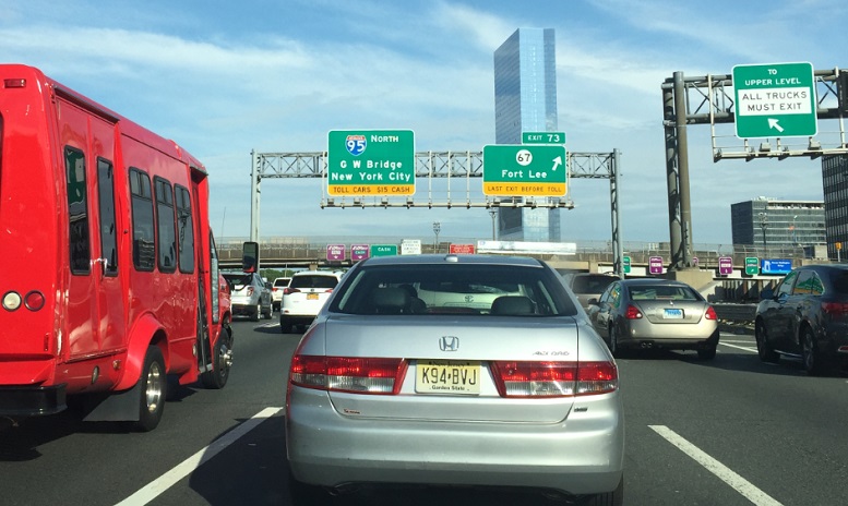
Nothing says “welcome home” like traffic problems in Fort Lee.
Great sketch of the Brambleton Avenue above; however, where did all those walkers come from in the AFTER sketch? They aren’t there in the BEFORE sketch. They all got out of their cars and walk?
[…] The western terminus of Norfolk, VA’s “The Tide” light rail line near the Eastern Virginia Medical Center is surrounded by mostly parking. Throw a stone in virtually any direction from the light rail platform and it’s going to land in a parking lot, a seven-level parking deck or a super-wide stroad. I wrote a little bit about that station area last year in this blog post. […]