The City of New Haven last issued a bike map nearly a decade ago, when average gas prices were less than $2.00 a gallon, and a little known State Senator named Barack Obama had just won a Senate seat to represent the State of Illinois.
In 2004:
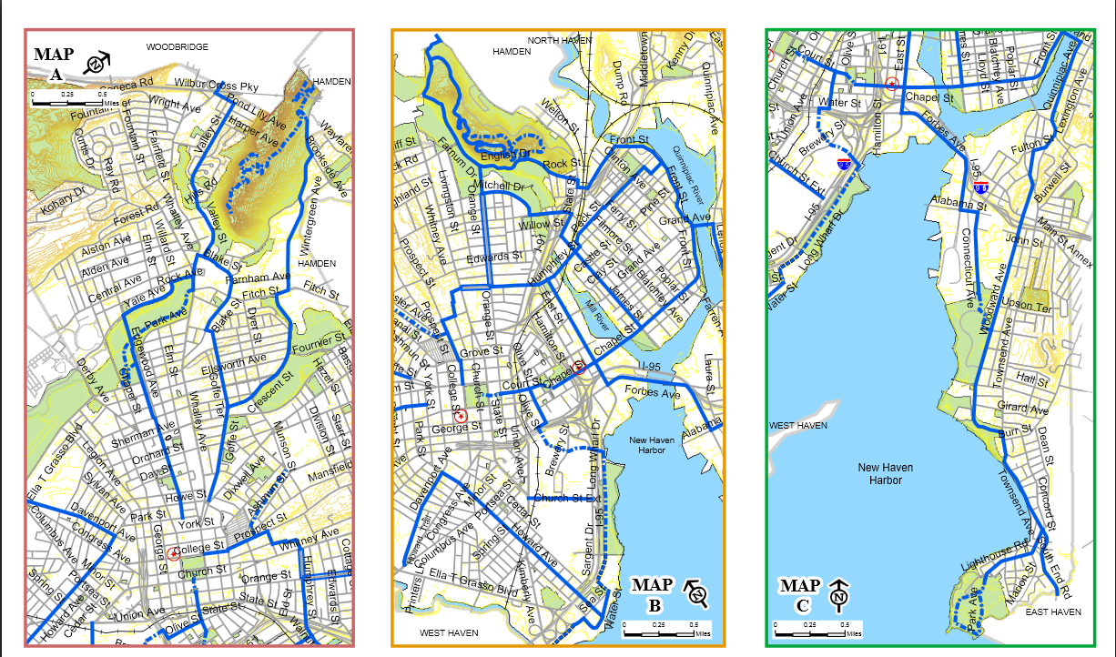
But since then, New Haven has undergone a cycling and livable streets renaissance, with the City passing the first Complete Streets policy in Connecticut, launching a Street Smarts campaign, striping bike lanes and working to make Route 34 more bikeable and walkable than what currently exists. Much of these results was the result of tireless advocacy at the local grassroots level, and a byproduct of advocates’ success has been a bike map that no longer reflects the realities on the ground. In order to change this, once again, cycling advocates pedaled to the rescue. Today, Elm City Cycling released an updated bike map that better reflects the strides the city has made in advancing cycling infrastructure.
2013 Map:

The map couldn’t come soon enough. As the New England weather begins to warm up and National Bike Month approaching, this map will help existing and new cyclists better navigate the city. And with this new map better outlining cycling infrastructure, here’s hoping the next decade sees even more cyclists on the road and another map that will need a substantial update.
Love it!!
アクセサリー チャンルー chan luu 店舗 http://www.web7777.com/